How We Are Leveraging Remote Sensing for Validation of the iSnobal Model
Leveraging Remote Sensing for Enhanced Validation of the iSnobal Model
Remote sensing is not merely a supplementary tool but a driving force behind the continuous refinement of the iSnobal model. By integrating remote sensing data into our validation procedures, we are able to obtain real-time insights into various environmental factors that influence water management dynamics.
Airborne and satellite data provide valuable information not just about snow cover, but also forest cover, a critical factor in water resource modeling. Snow accumulation and melt patterns can vary significantly between forested and open areas. By leveraging satellite imagery, we can account for these spatial variations and refine our simulations accordingly.
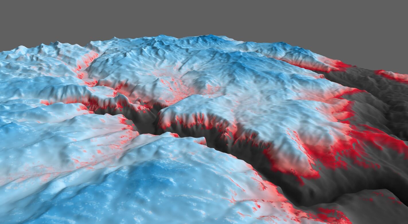 3D model of SWE
Partnership with Airborne Snow Observatories
Through our partnership with the Airborne Snow Observatories, Inc. and their use of planes equipped with lidar and spectrometers, we are able to analyze detailed information about snow distribution and reflectivity. Aside from direct use to improve and refine the snowpack state in our models, this data also provides insights about snow accumulation and melt that directly improve model performance.
The use of, and model improvements from aerial lidar data set us apart, allowing for a more detailed validation process compared to traditional methods. While researchers typically conduct a limited number of LiDAR flights in focused regions, our modeling system has been utilized in partnership with hundreds of ASO surveys. This has directly benefited water managers with real-time insights and led to numerous model improvements over the course of our partnership.
A key aspect of our validation process is the iterative correction of measurements based on real feedback. This adaptive approach ensures that the model remains responsive to changing environmental conditions, increasing its accuracy and reliability over time.
M3Works Modeling System
A unique feature of the M3Works modeling system is a testbed system that enables rapid R&D, even in real time. M3Works frequently runs multiple models in parallel to investigate the model’s sensitivity to parameterizations. If a model run performs better across our metrics, then it will be used for the reporting data resulting.
Our model is not confined to a single basin but is deployed in over 30 basins, demonstrating its applicability across diverse geographical settings and climates. By harnessing the power of aerial and satellite-based observations, we are able to enhance the accuracy, reliability, and applicability of the iSnobal model, paving the way for more informed and sustainable water resource management strategies.
3D model of SWE in the Boise River Basin
Micah Sandusky is a software developer, mechanical engineer, and scientific modeler. He started out using computational fluid dynamics to estimate wind power in mountainous terrain. He later launched into a snow hydrology career when he joined the USDA Agricultural Research Service to serve as the primary developer for the Automated Water Supply Model (AWSM), a framework now used by M3. Prior to cofounding M3 Works, Micah spent time as a developer in the commercial software industry where he cultivated his skills with data pipelines in the Cloud. At M3 Works, Micah coordinates our cloud infrastructure while developing new strategies for monitoring/maintaining our real time efforts to estimate snowpacks all across the Western US.
- M.S. Mechanical Engineering
- 10 years scientific modeling
- 10 years development experience
- 4+ years of Cloud experience

Solutions
Company
Resources
© 2024 M3Works. All rights reserved.